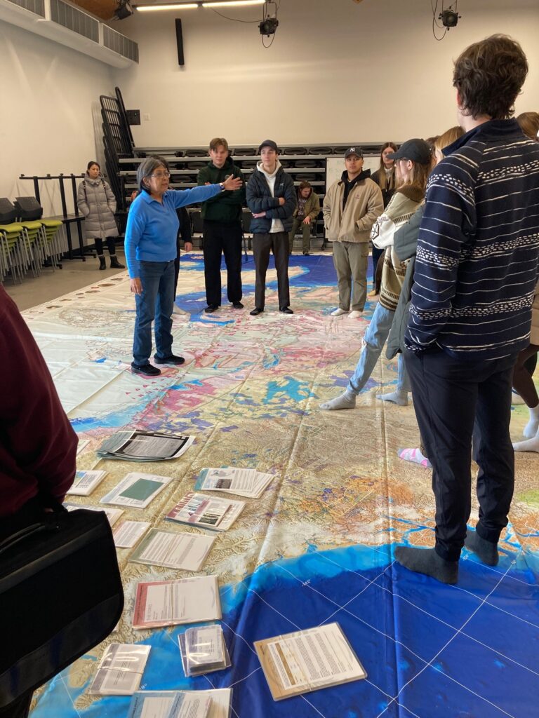
As students walked into room H100 the expression on their faces said it all.
Comments like; “Wow!” “Where did you get this from?” “This is amazing!” “I never see a map this large” “Great opportunity for students to learn about Indigenous people.”
There were many positive comments from students and a lot of questions asked regarding the content of the Indigenous Peoples Atlas of Canada Floor Map; Indigenous communities, residential school locations, etc.
Some students explored one area of the map, coastal British Columbia, as they are reading “Five Little Indians” by Michelle Good. Students wanted to see where the non-fiction characters of the novel went to residential school as Michelle Good mentions some locations along the British Columbia coastline. Using the large map gave students the insight of the novel and the characters and an understanding of where Indigenous people attended residential schools. The distance from home to school and often not going home at all. Students tried to find the location of their homes or of areas of interest to them.
Students had discussions and questions on how this large map can fulfill their requirement for Teacher Quality Standards Competency Five as a teacher, in their classroom and the whole school. What would the benefits of this being in the school? Sharing the information, having K-12 students view and wonder on the map locating Indigenous communities and residential schools. It presents a great opportunity to learn about Indigenous people.
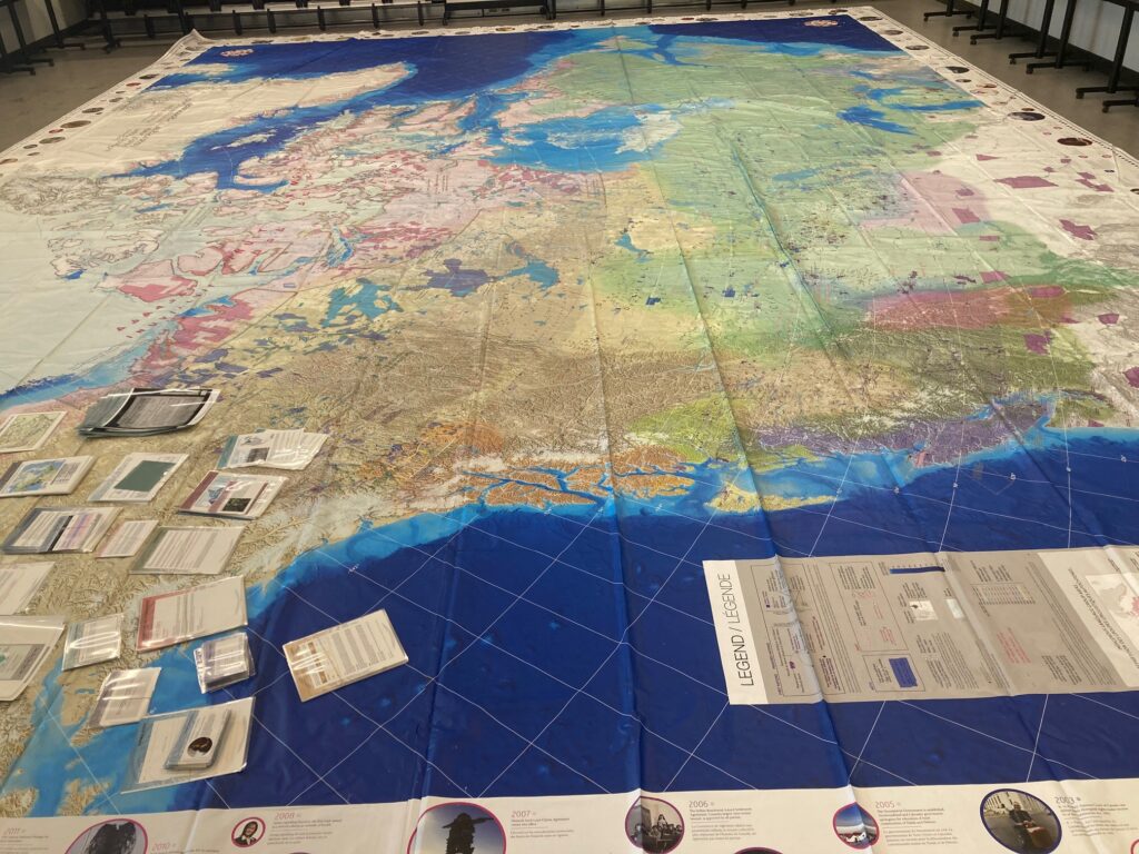
The Indigenous Peoples Atlas of Canada Floor Map is a large map a size of 11×8 metres. The large floor map represents Indigenous people across Canada without borders or boundaries. Names of Indigenous and tribal communities, residential schools, and reserves. A great resource for teachers, students and anyone who is interested in learning about Indigenous History, Culture, Climate Change, Governance, Lands, etc.
As a Tsuut’ina educator, Valerie McDougall instructs Indigenous Education EDER 329 at ST. Mary’s University for preservice teachers. The large Indigenous map is part of the course outline to assist and support preservice teachers in developing, implementing, gaining knowledge and understanding of Indigenous ways of knowing.
“The Alberta Teacher Quality Standard Competency Five – Applying Foundational Knowledge about First Nations, Métis and Inuit a teacher develops and applies foundational knowledge about First Nations, Métis, and Inuit for the benefit of all students, is one of six competencies that we immerse ourselves in,” said McDougall. “From Indigenous lesson planning, resources, storytelling, and the relationality and positionality of land and who they are in Treaty 7. Bringing in the large Indigenous map gives students the opportunity of a hands-on activity, a visual representation of Indigenous Lands and to see Indigenous lands without borders and boundaries. Understanding that Indigenous people did not have boundaries or borders before Treaties and colonization. Indigenous people traveled across Turtle Island to trade, migration, etc.”
Along the border of the map, there is a timeline. The timeline has information of Indigenous people throughout Indigenous Lands. Starting from 12,000 BC to 2017. Information such as Historical events, milestones and contributes of Indigenous people.
“The large Indigenous floor map is a great opportunity for preservice teachers and to other individuals to learn and visually see Indigenous communities, Residential Schools, etc.,” explains McDougall. “I would highly recommend to those who are instructing Indigenous History or Settler History to take the opportunity to view the map. I am sure they would all being saying “This is amazing!””